Precision Spraying
Targeted micro-dosing of fungicides, herbicides, and nutrients with electrostatic atomization.
+/- 2cm Accuracy
calonias consolidates treatment, monitoring, documentation, and field mobility into one practical service portfolio, allowing growers to source both execution and measurable operational outcomes from a smaller, clearer site structure.
Targeted micro-dosing of fungicides, herbicides, and nutrients with electrostatic atomization.
Rapid reforestation and cover crop dispersal using high-velocity pneumatic delivery systems.
Multispectral NDVI analysis and high-resolution thermal indexing to identify plant stress.
Ground-penetrating radar and moisture sensors map subterranean hydrology and compaction behavior.

Autonomous identification and biological control release for integrated pest management programs.

Indoor autonomous navigation for climate control, pollination, and vertical farm maintenance.
Automated compliance reporting, yield forecasting, and historical topographical log packages.
Integrate our systemic services into your existing farm management software and support workflow.
The former benefits material is now embedded directly into the services portfolio so operational value sits beside the services that produce it.
Centimeter-level precision targeting via RTK guidance reduces waste and keeps delivery concentrated on the canopy.
Swarming protocols and flight planning accelerate treatment windows across large or fragmented acreage.
Dynamic micro-dosing algorithms optimize input volume according to multispectral crop health signals.
Service execution is paired with practical field outcomes, from worker safety to reduced compaction and stronger access to terrain where conventional machinery loses efficiency.
Removing heavy machinery from treatment passes helps preserve pore space, infiltration, and root respiration in topsoil.
Remote operations reduce direct human contact with concentrated chemical inputs while maintaining repeatable treatment quality.
Service crews can operate across terraced vineyards, irregular boundaries, and moisture-sensitive ground with fewer logistical delays.
Telemetry, documentation, and field records make service outcomes easier to review for agronomy teams and enterprise buyers.
calonias systems are designed for locations where traditional tractors or boom rigs create delay, compaction, or incomplete treatment patterns.
The underlying business notes stress that drone work only becomes valuable when raw field activity turns into decisions, reports, and follow-up action. These deliverables make the services page feel more complete.
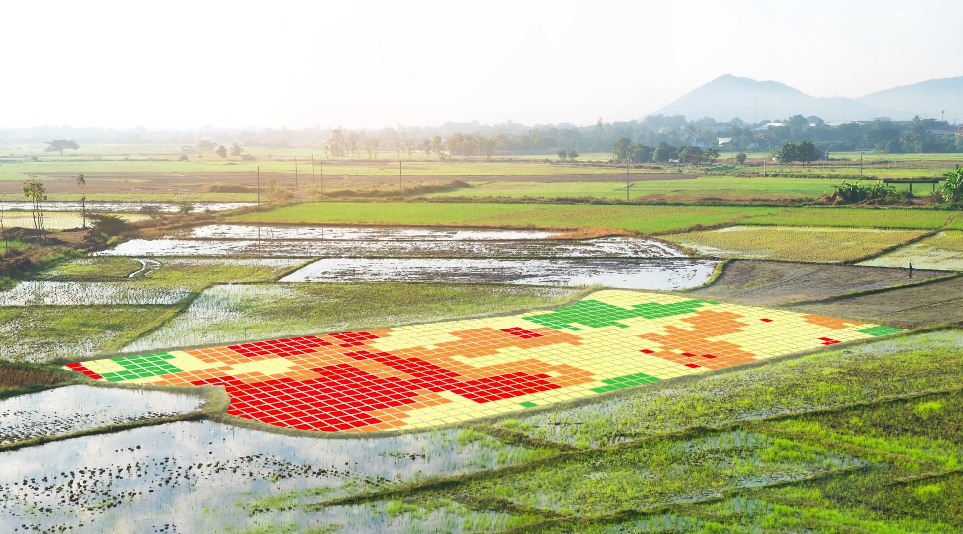
High-resolution imagery and health analysis are translated into map layers that show where intervention should happen first.
Spraying and seeding projects can be documented with coverage logs, acreage summaries, and treatment traceability.
Thermal and mapping outputs identify dry zones, oversaturation, drainage irregularities, and fertility variation across the field.
Aerial photography and videography support insurance records, land planning, infrastructure review, and agronomic tracking over time.
The website becomes richer when services are anchored to real agricultural contexts instead of generic feature lists alone.
Targeted application and aerial monitoring help preserve quality where per-acre crop value is high and field geometry is difficult.
Coverage speed, scouting reduction, and prescription planning improve consistency across large acre blocks and multiple sites.
Drone programs remain useful where ground-entry timing, soil compaction risk, or slope conditions limit conventional equipment.
Monitoring, mapping, and livestock observation can be combined within one operational workflow instead of multiple disconnected services.